VuwCTF 2026 - OSINT - cousin
Challenge: OSINT - cousin
4 solves left out of 125 teams left (after bans); First Blood by OP_EN.
1. Description and handout
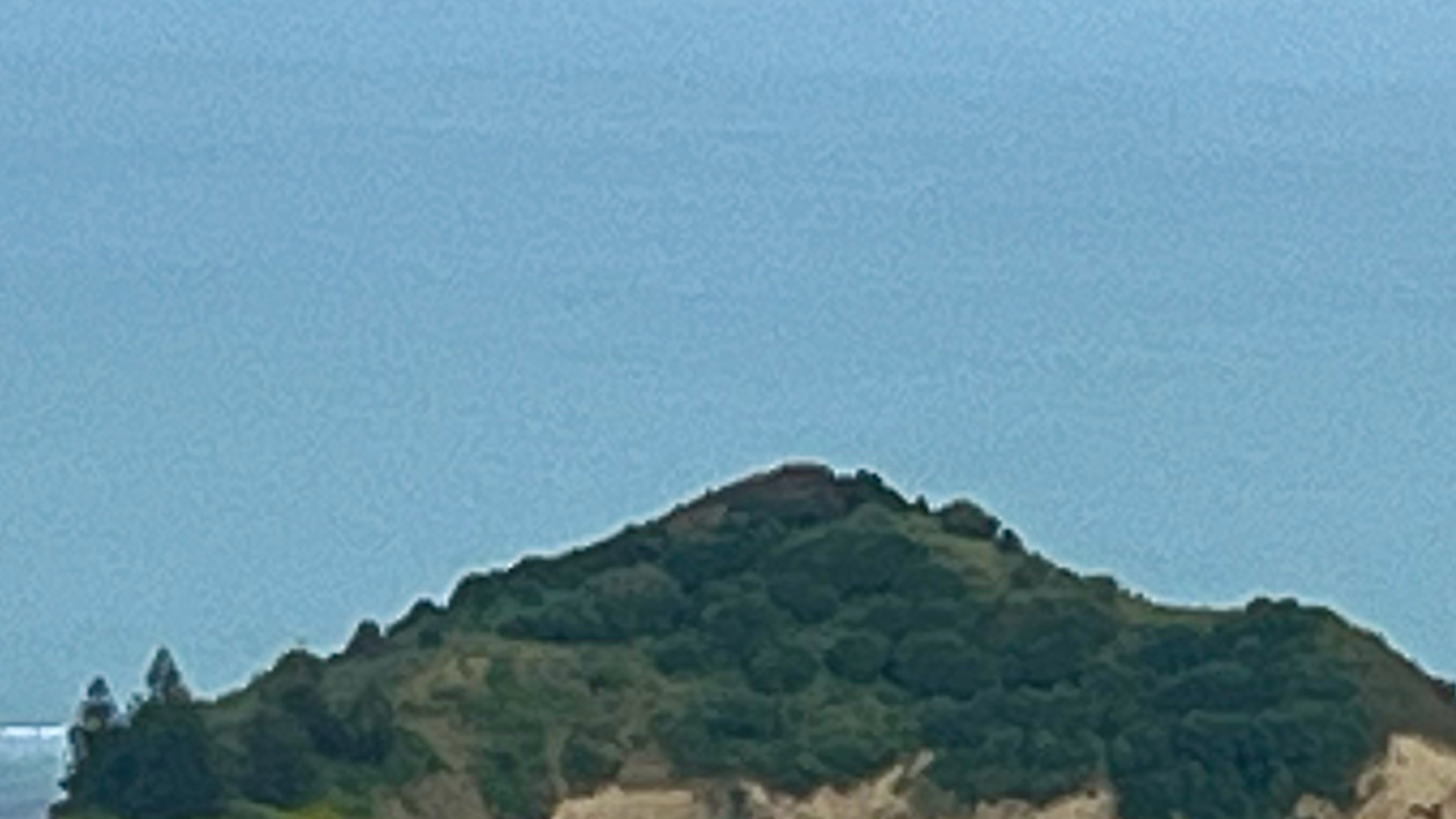
I parked near the intersection of a Park and a Drive and walked up to an NZ trig station to take this photo. Find the trig identification code and the date that the island in the photo was legally named. > Flag format is VuwCTF{MKID_YYYY_MM_DD}
Handout:
2. Initial analysis
From the challenge description we can gather that:
- The island is somewhere in New Zealand (duh)
- The island is close enough to be photographed from a nearby triangulation station
- The trig station is in a close distance to an intersection of two streets; one with a name ending with the word “Park”, and one with a name ending with the word “Drive”
From the photo itself we can note the general “outline” of the island, not much beyond that.
3. Reverse image search
The reverse image search lottery does not produce any results, which I’m sure was the author’s intention.
4. Locating the photo spot
A good starting point for narrowing down the location is making use of the fact that the photo was taken near the intersection of a street whose name ends with “Park”. Such street names are rare in the Angloshpere, but they do exist.
A simple overpass turbo query can be used to identify and show such streets on the map:
1
2
3
4
5
6
7
8
9
10
11
12
13
[out:json][timeout:60];

// Limit search to New Zealand:
area["ISO3166-1"="NZ"][admin_level=2]->.nz;

// Streets whose name ends with "Park", note the regular expression-like use of $:
way(area.nz)
  ["highway"]
  ["name"~" Park$", i];

out body;
>;
out skel qt;
The above query returns a manageable number of results for “manual” verification on Google Maps + Street View. Things to look for:
- Close proximity of the street to a coastline
- Presence of islands within “photographable” distance off the coastline
One of those results leads us to the vicinity of Gisborne, where not one, but two junctions of Tuamotu Park and Hamilton Drive exist.
As Google Street View coverage of the coastline in the area does not exist, confirming the match requires a manual image search for Tuamotu Island Gisborne.
5. Locating the trig station
Searching for trig stations in the area can also be carried out in overpass turbo:
1
2
3
4
5
6
7
8
9
10
11
12
13
14
15
16
17
18
19
20
[out:json][timeout:60];

// Limit this search as well to New Zealand only:
area["ISO3166-1"="NZ"][admin_level=2]->.nz;

// Limit this search further to the vicinity of Gisborne:
node(area.nz)
  ["place"="city"]
  ["name"="Gisborne"]
  ->.g;

// Show trig stations within 10 kilometres of Gisborne:
node
  ["man_made"="survey_point"]
  ["survey_point:structure"="beacon"]
  (around.g:10000);

out body;
>;
out skel qt;
The above query returns a few results:
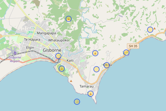
Surely, the handout photo could have only been taken near a trig station located on Tuaheni Hill near the coast:
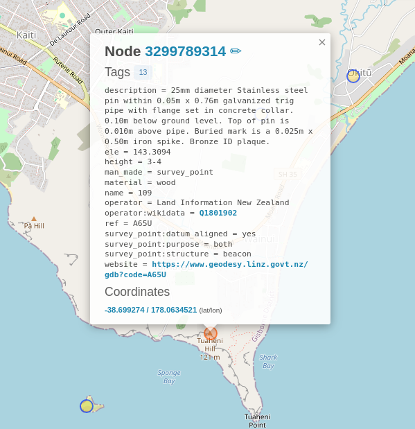
The trig station code can be noted directly from the above result: A65U.
6. Obtaining the name legalisation date
A lengthy Google search eventually leads to an official media release from The New Zealand Geographic Board, announcing over 800 name decisions, primarily in Gisborne area. Since links in the release no longer work, as NZGB notices older than a few years are no longer present on their website, another manual search was needed. The 18 November 2021 notice was archived by gazette.govt.nz.
7. Flag
VuwCTF{A65U_2021_11_18}
8. Closing comments
As is usually the case with CTF write-ups:

Please keep in mind that solving this challenge was far from being linear, and also involved spending time on:
- Google phrase or image searches
- Getting overpass turbo queries to work
- Getting VPN to work in order to access
gov.nzsites (yes, I was blocked for some reason) - Using the wrong approach of trying dates from the wrong sources
Cheers,
[OP_EN]tommy_kay